Chart of Arctic Sea Ice Extent

Satellite based records of Arctic sea ice began in 1978. By late October of 2020, the main nursery of Arctic sea ice in Siberia had yet to start freezing. The late freeze could amplify feedbacks that cause more decline of sea ice. Less sea ice means less of a white area to reflect the sun’s heat back into space. When ice forms late in Siberia, it could be thinner and more likely to melt sooner as it drifts westward. This could mean fewer nutrients for Arctic plankton, which will then have a reduced capacity to draw down carbon dioxide from the atmosphere.
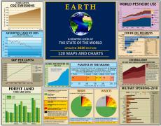
More Climate Infographics


Sources
NOAA; https://psl.noaa.gov/forecasts/seaice/
Tags: arctic, ice, climate change, global warming, arctic sea ice extent, climate
Sign up for EARTH Dispatches
Enter you email below to get jaw dropping charts and maps delivered straight to your inbox.
Get the EARTH presentation
A 150 page high-resolution PDF containing all updated maps, charts and data on EARTH website; use as an information-packed educational slide show, printed booklet or a set of single-page handouts.
Learn More