Global Education Project EARTH
Support Earth Education   Donate

Arctic Ice

The essential data about arctic ice explained in 3 infographics. Detailed charts and maps covering arctic sea ice extent, arctic geography, winds, ice, and currents, climate and more. Learn the truth about arctic ice and how it relates to the state of the world on The Global Education Project website with un-biased facts from the most reliable sources.
Arctic Sea Ice Extent Satellite based records of Arctic sea ice began in 1978. By late October of 2020, the main nursery of Arctic sea ice in Siberia had yet to start freezing. The late freeze could amplify feedbacks that cause more decline of sea ice. Less sea ice means less...
Arctic Geography, Winds, Ice, and Currents Industrial air pollution from the developed world is carried on the dominant wind currents up to the Arctic. After settling onto the tundra, snow and ice, it is absorbed into the food chain. The people and creatures there have had some of the highest...
Climate
Historical and contemporary overview of greenhouse gas emissions and atmospheric concentrations—which countries emit the most CO2, total and per capita; methane; ocean warming and sea level rise; global temperature projections; glacier and ice loss.


Page 1 of 1
If you didn't find the arctic ice data you needed, try searching with a different keyword related to arctic ice or browse information by category.

Sign up for EARTH Dispatches

Enter you email below to get jaw dropping charts and maps delivered straight to your inbox.

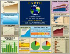
Get the EARTH presentation

A 150 page high-resolution PDF containing all updated maps, charts and data on EARTH website; use as an information-packed educational slide show, printed booklet or a set of single-page handouts.

Learn More

Test your EARTH Savvy

How many litres of water are needed to produce one kilogram of beef?